
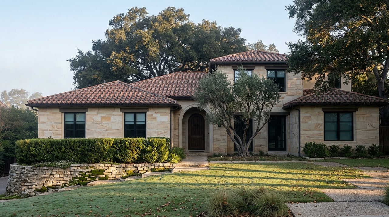
A builder walks a one-acre parcel in Saratoga with a tape measure and a mental spreadsheet. The house is dated, the setback lines look generous, and the assumption forms almost automatically: split it, build two, sell both. Then the zoning map comes back from the planning counter and the math stops working. The parcel sits in R-1-40000. Forty thousand square feet is the minimum lot size in that district, not the maximum lot area available to split. One acre is roughly 43,560 square feet. There is no clean way to carve that into two conforming lots.
This is the conversation that happens quietly, after the offer is written and before escrow closes, and it explains why so many Saratoga parcels that look like obvious subdivision candidates never become one. The city's zoning code was not built to make splitting easy. It was built to keep the town looking the way it already looks, and the acreage numbers back that up.
The Zoning Math Nobody Runs Before Making an Offer
Saratoga's residential zoning is dominated by two large-lot categories. The Hillside Residential district covers roughly 1,850 acres, the largest single zone in the city. The R-1-40000 district, requiring a 40,000 square foot minimum lot, covers about 2,352 acres. Together those two categories account for more land than any other zoning classification the city maintains. R-1-10000, the smallest of the standard single-family minimums at 10,000 square feet, adds another 1,482 acres.
By contrast, the zones that actually permit higher density are small. The R-M multifamily districts (R-M-3000, R-M-4000, R-M-5000) combine for roughly 140 acres citywide. Commercial land is even scarcer: the Village's historic commercial core (CH-1 and CH-2) totals under 33 acres, and the mixed-use districts near the Village add about 37 acres more.
| Zoning category | Approximate acreage | What it signals |
|---|---|---|
| Hillside Residential (HR) | ~1,850 acres | Very low density by design, slope-driven restrictions |
| R-1-40000 | ~2,352 acres | 40,000 sq ft minimum lot, splits rarely pencil |
| R-1-10000 | ~1,482 acres | Smallest single-family minimum, most realistic split candidate |
| R-M (multifamily, combined) | ~140 acres | Narrow band where density is even legally possible |
| Commercial (CH-1, CH-2) | ~33 acres | Historic Village core, tightly constrained |
Read the table as a map of intent rather than a list of categories. The two largest zones in the city both carry lot minimums that make a conventional two-way split arithmetically impossible on the majority of large parcels a buyer might assume are subdividable. A five-acre hillside property is not five times more likely to split than a one-acre flatland lot. In Hillside Residential, slope density formulas often push the effective minimum lot size well above the flatland baseline, so the acreage that looks like abundance on a listing sheet frequently isn't.
Two More Filters Before You Even Reach the Property Line
Even where the zoning minimum technically allows a split, two more layers narrow the buildable envelope before a shovel goes in the ground.
The first is slope. Any site with an average grade over 8 percent needs a surveyor to confirm the number, and once slope crosses 10 percent, the city reduces the net site area used to calculate allowable floor area. A hillside lot with a large paper acreage can end up with a legal building envelope that reads much smaller once the slope discount is applied.
The second is Saratoga's tree ordinance, and this is the one that catches people who've built elsewhere off guard. Any tree with a trunk diameter of 10 inches or more is protected, regardless of species. That threshold isn't limited to landmark oaks or street trees. It covers ordinary specimen trees that a buyer walking the lot might not think twice about. Once a protected tree is on site, an arborist report is required for any construction proposed within five feet of its canopy dripline, and that requirement applies to grading, trenching, equipment storage, and parking, not just the foundation itself. In practice, the tree ordinance often shapes the buildable footprint as much as the setback lines do. A parcel with three or four mature trees scattered across it can lose a meaningful share of its theoretical building envelope before the architect finishes the first site plan.
Layer slope reduction and tree protection on top of a 40,000 square foot zoning minimum and the picture becomes clear: the constraint on Saratoga subdivision isn't one rule. It's three rules stacking against the same acre.
The Path That Actually Works: SB9, Not a Subdivision Map
None of this means Saratoga land is closed to smart investment. It means the tool that works is usually not the tool a builder brings from a market where conventional subdivision maps are routine.
State law, specifically Senate Bill 9, opened a narrower and more specific pathway for single-family parcels: the urban lot split. Saratoga layers its own standard on top of the state framework. A city SB9 lot split that creates two parcels needs combined impervious surfaces across both resulting sites of at least 5,000 square feet, for example a 2,500 square foot allotment on each half. That single number does most of the work in determining whether a given parcel is a realistic SB9 candidate once slope and canopy are factored in, since a lot heavy with protected trees or steep grade may not have 5,000 square feet of buildable impervious area left to allocate at all.
Before running the numbers on a Saratoga parcel, confirm each of these:
- Is the property in a single-family residential zone
- Does the site have enough net buildable area, after the slope reduction and any protected-tree setbacks, to reach the city's 5,000 square foot combined impervious surface threshold
- Is the property in a Wildland Urban Interface or elevated Fire Hazard Severity Zone, which triggers its own fire prevention and access requirements regardless of the lot split
- Will the resulting parcels still clear the underlying zoning district's other standards, since SB9 doesn't override every local requirement
This is the honest answer to the question every developer eventually asks about Saratoga: the path to adding a second unit on one parcel usually runs through the city's SB9 impervious-surface math, evaluated against the same slope and tree constraints that apply to any other project, rather than through a conventional tentative subdivision map.
What This Means in Dollars
The zoning math above is not an abstract planning exercise. It shows up directly in what land costs and what it takes to build on it.
Tear-down candidates in Saratoga, meaning an existing home purchased primarily for its lot with the structure destined for demolition, typically trade between $2 million and $5 million, with land value accounting for most of that price. Vacant parcels are rarer and move faster when they surface, ranging from roughly $1.5 million for smaller flat sites up to $5 million or more for larger hillside parcels with view potential. Custom construction costs run from $450 to $900 or more per square foot, and the full process from initial design through move-in typically spans 18 to 30 months.
Read those figures against the zoning table and the logic connects. Because so much of Saratoga's land sits in large-lot categories that structurally resist subdivision, buildable inventory stays scarce, and scarcity is already priced into land value rather than into any expectation of future lot splits. A buyer paying $3 million for a tear-down candidate is not typically pricing in the option to create a second parcel. They're pricing in a single, well-located building site in a town where that kind of site doesn't come up often. Anyone underwriting a Saratoga acquisition on the assumption that a large lot equals two future sales should run the slope report and the tree survey before that number goes into a pro forma, not after.
Reading a Saratoga Parcel Correctly
The practical takeaway for anyone comparing Saratoga to other Silicon Valley towns as a development target is straightforward. Acreage on a listing sheet is not the same as buildable capacity. The town's own zoning geography, weighted heavily toward Hillside Residential and 40,000 square foot minimums, was drawn to preserve exactly the low-density, tree-canopied character that makes Saratoga desirable in the first place. Slope calculations and the protected tree ordinance then narrow the buildable envelope further, often before a buyer has fully priced the parcel. The SB9 urban lot split is the realistic mechanism for adding a second unit in most cases, and it comes with its own eligibility list that has to be checked parcel by parcel.
None of this makes Saratoga a poor place to build or invest. It makes it a market where the entitlement homework has to happen before the offer, not during due diligence. A parcel that clears zoning, slope, and tree review cleanly is worth more to a serious buyer than a larger parcel that looks better on paper but stalls at the planning counter.
FAQ
Does owning a large lot in Saratoga mean I can split it? Not automatically. Most of Saratoga's land sits in zoning categories with minimum lot sizes of 10,000 to 40,000+ square feet, and hillside slope calculations can push the effective minimum higher still. Confirm the district and run the slope numbers before assuming a split pencils out.
What actually triggers the tree ordinance? Any tree with a trunk diameter of 10 inches or more, regardless of species. Construction proposed within five feet of that tree's canopy dripline requires an arborist report, and the requirement covers grading, trenching, and equipment storage, not only the building footprint.
Is SB9 available on every Saratoga parcel? No. It applies to single-family residential parcels, and Saratoga requires combined impervious surfaces of at least 5,000 square feet across the two resulting lots. Sites with significant slope, protected trees, or Fire Hazard Severity Zone designations need to be checked individually before assuming that threshold is reachable.
Land decisions in Saratoga reward the buyer who runs the zoning, slope, and tree math before the offer goes in, not after. If you're evaluating a Saratoga parcel for a custom build, a tear-down, or a lot split, Stilla Raissi can walk the site with you and put the entitlement picture on the table early. Request a Private Valuation to start that conversation.